Crowe Valley Conservation Area (CVCA) Mapping Tool
Property owner's frequently asked questions...
Q - Within Havelock-Belmont-Methuen, what areas fall within CVCA's jurisdiction?
Q - How do I know if my property has regulated area(s).
Q - How do I know if I need a CVCA permit to build?

Crowe Valley Conservation Area's Jurisdiction Mapping Tool
Check out CVCA's new Map Viewer to find out! (Click link below to launch)
https://experience.arcgis.com/.../e77015ae4fc845a7af68e50...
You can find the Map Viewer on their website www.crowevalley.com by going to 'Permits & Planning' and then 'Map Viewer.' Find a property using the search bar or navigate using the map controls.
The Map Viewer allows you to find out:
You can find the Map Viewer on their website www.crowevalley.com by going to 'Permits & Planning' and then 'Map Viewer.' Find a property using the search bar or navigate using the map controls.
The Map Viewer allows you to find out:
- If a property is within the CVCA's jurisdiction / watershed; AND
- If a property has regulated area(s)
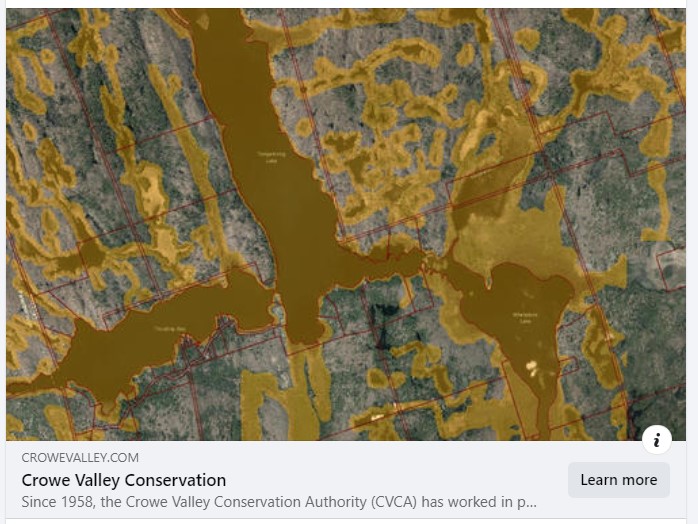
The orange area shows the 'Approximate Regulation Limit' where a permit may be required from CVCA before undertaking any development activities. The Regulation Limit is subject to change based on actual property conditions and site verification of regulated features.
KEEP IN MIND: Some regulated features, such as wetlands, may not be mapped but are still regulated.
If you aren't sure about the map and if a property is regulated (or just need someone to talk to) please contact their office for more info at (613) 472-3137.
Sign up to our Newsletter
Stay up to date on the township's activities, events, programs and operations by subscribing to our eNewsletters.
